An Advanced TDB Editor for Garmin's Mapsource/Basecamp
Features include locking or unlocking of maps,adding copyrights,(dis)abling printing etc
Garmin's DEM basemap which comes with many gps devices is pretty basic and blurry showing 3d features only if you zoom out ! For a gps you need DEM files which come with most TOPO maps. Fortunately, we can now generate our own DEM files based on freely accessible hgt data. Unfortunately, such maps cannot be exported to a gps without changing & recompiling the tdb file. TDB Editor 3 checks for DEM files and adds DEM data to your tdb file. This enables you to quickly and easily export 3d maps to your gps device :
|
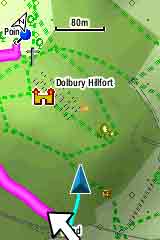 |
| Customized DEM on a GPS |
|
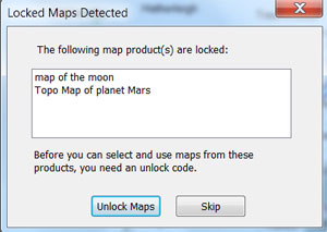
Locked Maps Detected You can save your City Navigator Maps to your PC but your GPS device needs to be plugged in. See below for more information. |
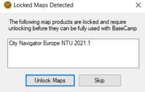 |
| Locked Map |
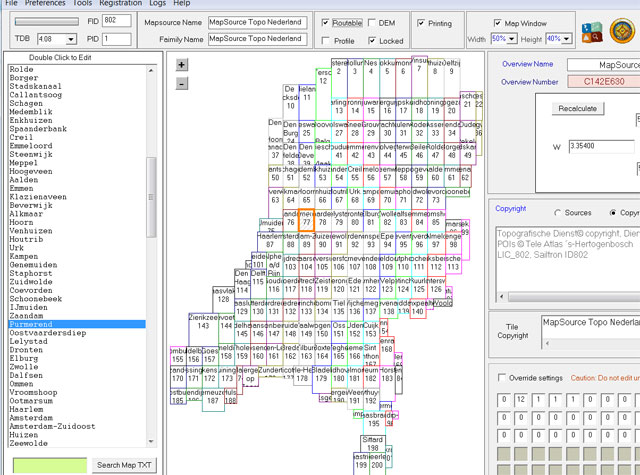 |
| Tdb Editor 3 |
| You may have to refresh this page to see latest version |
| Windows 7/10 click here |
| If you are concerned check out https://www.virustotal.com/ |
Download & Manual
| Secure DownloadTDB Editor 3.11 (W10 compatible) |
Secure Download TDB Editor 3.11 portable |
| Secure Registration of TDB Editor |
| Secure Download TDB Editor 3 manual |
How to Start
- Unzip Torquay.zip
- click install.bat to in stall map in Mapsource / Basecamp
- Open torquay.tdb and explore
- TDB Editor lists tdb files used by Mapsource for easy loading & editing.
- Free version allows you to test out TDB Editor on a lockable map of Torquay .
- See the effect of unlocking or locking a map, adding or removing printing options etc etc
How do I find a tdb file?
All Mapsource & Basecamp maps are controlled by a .tdb file..
|
 |
| Opening a Tdb File |
Youtube : How to (un)lock maps & more
 |
| Locking or Unlocking Maps |
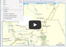 |
| Youtube Tutoirial |
| How to lock maps, disable printing, reduce a map window |
Control Mapsource/Basecamp Printing Options
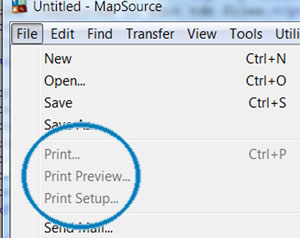 |
| Editing Printing Options |
 |
| Showing Map Window |
How to ...
- restore Mapsource when it crashes
- rename any mapsource/basecamp name
- change mapnames so they are easier to read on your gps
- Lock & Unlock all your maps
- Unlock TOPO maps on Mapsource/Basecamp only
- add/remove routable option
- force direct routing when it doesn't work
- add/remove profile(height) option.
- add or edit copyright description when creating your own maps
- create or remove 'Reduced map window for printing' and other (printing or viewing) messages
- disable any form of printing.
- add or resize Restricted Window View
- quickly identify & edit mapnames, useful when you want to isolate a particular IMG file.
- nvestigate various byte streams and explore the properties of many important but as yet unknown bytes. You cannot do this with a hex editor as all data has to be recompiled!
- Add your own copy right message
- Edit map overview properties.
- Resize Map Window
- Add DEM data so Mapinstall can export maps with DEM to a gps device