Best Warren House Inn Walks |
Warren House Inn was built in 1845 opposite a house, now destroyed , which queched the thirst of many a tin miner.
Two favourite walks starting near this pub which has to rely on its own electricity.
| What to explore? |
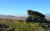
- Ruins of Tin Mines
- Medieval Village
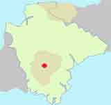
| Small Car Park off B3212 , 150m NE of the pub The pub lies 2 miles North East of Postbridge on the B3212 |
| what3words ////morphing.wiped.slightly | |
| SATNAV Postcode:PL20 6TA |
Walk 1 Medieval Village (5.1 miles)
Difficulty:![]()
A great 5 mile hike to explore Dartmoor and its tin mines.
Walks start near the Warren House Inn, which looks quite weatherworn from the outside but promises a warm welcome inside.
We recommend you download the route below as the following instructions are a brief description of the walk. 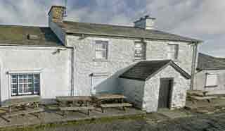
The Walk
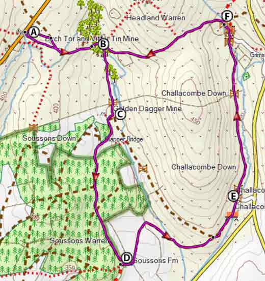
A From the Car Park follow a bridle path which takes you down to Birch Tor.
B Cross the bridge then follow a bridle path heading South to a gate then continue past Golden Dagger Mine.
C After 105 m turn right and take a bridle path to the forest.
D After a mile through the forest the track makes a sharp turn heading east.
Continue along this track past Boussons Farm keeping the hill (Challacombe Down) on your left.
E After the medieval village ignore a drive on right but continue North not crossing the small river Some stretches of the route are not clear.
F At a fingerpost signed Warren House Inn turn left.
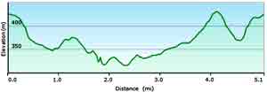
length: | 5.1 miles |
terrain: | tracks bridle/ footpaths |
| country lanes | |
main roads | 0 % |
yes | |
altitude range | 72 - 173 m |
quality of track | *** |
| FIT Route for Watches / GPS | |
| Show on Google Earth | |

Warren House Inn Walk 1
| Walks near Warren House Inn | |
| Grimspound | |
 | During the bronze age Grimspound , made of granite blocks , enclosed 24 hut circles, suggesting a milder climate and an abundance of trees. Two popular walks. |
| Postbridge | |
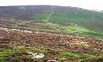
 | A popular and varied forest walk with lots to see:bronze age stone & hut circles, a clapper bridge & Bellever Tor. |
| Moretonhampstead | |
 | Moretonhamstead , gateway to Dartmoor, is an ideal town for walkers to explore the lush edge of the moor. |
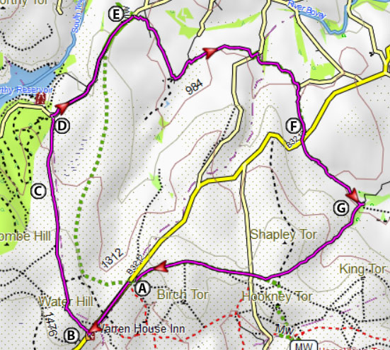
Walk 2 Chagford Common (8.8 miles)
Difficulty:![]()
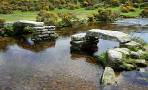
An invigorating 9 mile hike following long stretches of the Two Moors Way with lots to see including a stone row & hut circles.
Choose a fine day as there is little shelter throughout the walk.
The Walk
A With back to car part turn left and continue on the verge of the main road to the pub.
B Just before the pub turn right and head up roughly 90 degrees to the main road - the path is barely visible.
At top of hill head towards the right edge of Fernworthy Forest - the path is not clear but eventually takes you to a lane leading to Fernworthy Reservoir.
C Stone Row and hut circles.
D After a mile take footpath signed with a 2 Moors Way symbol on right.
This meanders via Lower Shapely, Hurston, Lettaford.
E Take care crossing the B3212 and continue following the 2 Moors Way.
F At Westcoombe, where you join a lane , take path on right - do not cross stream.
Continue following the 2 Moors Way back to the car park.
Download Route:
Warren House Inn Walk 2