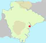
Dawlish | 6 TOP Walks |
| Select Your Walk | Walk 1 (2.5 m) | Walk 2 (3.6 m) | Walk 3 (2.5 m) | Walk 4 (1.7 m) | Walk 6 (8.2 m) |
| Classic Dawlish | Dawlish Warren | Town Trail | Holcombe | Olde Rural Devon |
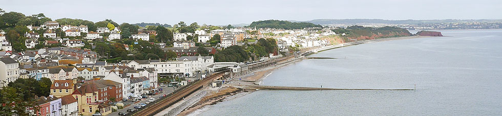
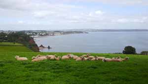
Dawlish , is known for its sandy beaches, black swans & the Brunel railway line along its coast.

Jane Austen visited Dawlish in 1802 for a long holiday.
She seemed to have been unimpressed with its library.
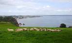
| Black Sawns, stunning views & beach |
| Witches Bowl, 11Queen Street |
The name Dawlish means 'settlement on the black river'
 | How to Follow GPX Routes on your mobile. |
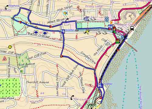
Walk 1 Classic Dawlish (2.5 miles)
Difficulty:![]()
| Start :Station Road or West Cliff Rd |
This gentle walk follows part of small river, the Dawlish Water, with its famous black swans introduced from Australia.
The Walk
AWith back to station, turn Left onto Richmond Close
.
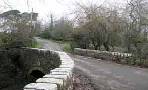
After crossing bridge, turn Left following the SW Coastal Path
.
Continue along the sea front passing some Public Toilets and head towards Cove Cafe.
BJust before cafe, turn Right onto steps (SW Coastal Path) - quite a steep climb
.
When path splits , turn Left
.
When you have reached the top, turn Right and continue along Teignmouth Hill - enjoy the views!
C Turn Left into West Cliff Road
.
After 320m (4 mins) , turn Right onto a public footpath and descend towards the river
.
Continue along Barton Hill
.
Just before the river, turn Left onto a footpath next to the Car Park passing the back of the Hospital - do not cross the bridge
.
Continue following footpath into park
.
DIn the far corner of the park , bear Left near the �insect hotel� . The path now climbs steadily
.
When path reaches road , turn Right and continue along Barton Terrace
.
At the T Junction, turn Right
.
Next to church, turn Left on to a public footpath along side of church
.
Continue following path
.
At the end of path, turn Right along Aloler Hill
.
Continue ignoring Road to Ashcombe
.
When joining road to Ashcombe, bear Right
.
Continue passing Badlake Hill & Meadow Park on right
. Ignore public footpath on right.
EJust after the Humpy, a private rd , turn Right into small lane.
This leads to a public footpath. Follow this path & when joining another footpath on right, turn Left
.
Almost immediately , turn Right heading towards the sea
. You can enjoy some spectacular views along this stretch.
Continue going down hill
.
When joining a residential Rd, turn Right along Stockton Hill
.
FTurn Left onto a service road leading to a public footpath
.
Continue along this path & when joining Strand Hill, turn Right and descend back into Dawlish
.
length: | 2.5 miles |
time: | 1 hrs 15 mins |
main roads | 1 min |
altitude range | 1 - 97 m |
quality of track | **** |
Download Route
| Download GPX | Mobile or GPS | |
| Download FIT | Watches | |
| Google Earth | ||
| Residential West Cliff Road |
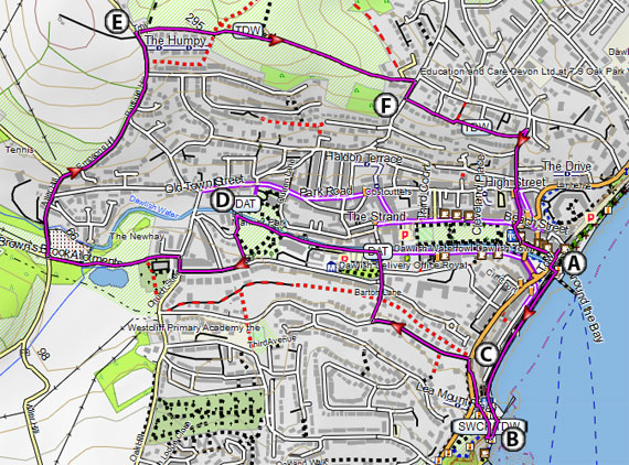
Map of Walk 1
| Walks near Dawlish | |
| Dawlish to Holcombe | |
 | An ideal pub walk to Holcombe with magnificent views of the Devon coastline. |
| Ashcombe | |
 | This walk follows a lush and undisturbed valley of the 'Dawlish Waters' and retraces a route vividly described by the 18th century John Swete in his 'Journal Eleven' |
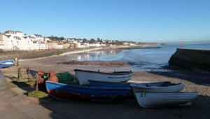
| Cockwood | |
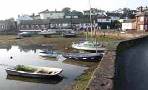 | Two pleasant walks from this picture postcard village. |
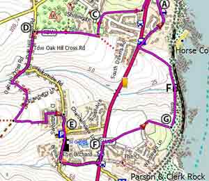
Walk 2 Dawlish Warren (3.6 miles)
Difficulty:![]()
A delightful & easy walk following mainly footpaths into Dawlish Warren Nature Reserve & sandy beaches to the mouth of the river Exe.
The route returns along the sea following the Southwest Coast Path to Dawlish town.
| 1 : Rainbows Cafe , Dawlish Warren 2: A379 near shops |
Download Route
| Download GPX | Mobile or GPS | |
| Download FIT | Watches | |
| Google Earth | ||
| map of Dawlish Warren |
|
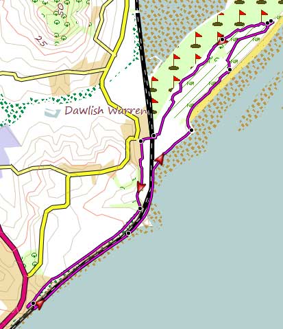
Map of Walk 2
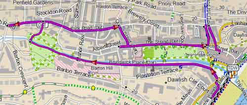
Walk 3 Town Trail (1.7 miles)
![]() Difficulty:
Difficulty:![]()
| Best Devon Town Trails |
A pleasant town walk highlighting Dawlish's uniqueness and history.
| This is one of our 'Thirty Minute Walks' |
| Witches Bowl , 11 Queen Street |  |
Map of Walk 4 Dawlish Town Trail (1.7 miles)
Walk 4 Dawlish to Holcombe (2.5 miles)
Difficulty:![]()
A short & quite challenging but varied pub walk.to Holcombe with stunning views of the sea.
Check out Dawlish to Holcombe
Walk 5 Pub Trail (1.5 miles)
Difficulty:![]()
A great trail taking in all the 9 surviving pubs in Dawlish.
Map of Walk 4b Dawlish Ale Trail (1.5 miles)
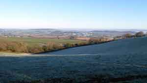
Walk 6 Exploring Olde Rural Devon (8.2 miles)
Difficulty:![]()
| Start 1:Station Road Start 2:Elme Grove Road |
This quite strenuous & varied walk takes you back in time and inland towards Gulliford & the foothills of Haldon along a very ancient track.
Part of the track can be muddy after heavy rain.
It returns via Pitt Farm , a 13th century farm (1215), & follows footpaths & country lanes, including Port Road, part of the Port Way used by 'pirates' to smuggle their wares from the Teign to Dawlish.
The final stretch joins the South West Coastal Path at Dawlish Warren.
Allow 3.5 - 4 hours
The views are quite breathtaking.
Download Route
| Download GPX | Mobile or GPS | |
| Download FIT | Watches | |
| Google Earth | ||
Elm Grove Road |
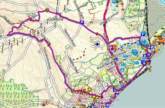
Map of Walk 5