Best Bampton Walks | a hidden gem steeped in history |

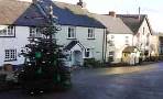
Bampton is a charming Saxon town north of Tiverton boasting several pubs and an old motte and bailey castle.
- The town was probably founded by the Saxons as a crossing point for two important trading routes,
- In the 11th century, a Norman castle was built
- In the 13th century, Bampton was granted a market charter by King Henry III.
- In the 18th century, Bampton thrived because of the wool trade. It was at this time many of the old stone houses were built by wealthy merchants.
- The town also became famous for its Morris Dancing traditions, which are still celebrated today.
- Its annual fair, always on the last Thursday in October, is well worth a visit!
| What to explore? |
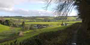
- Delightful views
- Remote Countryside
- Bampton Castle
- Site of Roman Fort
| Station Road Car Park |
Walk 1 Wide views & site of Roman Fort (6.9 miles)
Difficulty:![]()
| Start : Station Road Car Park |
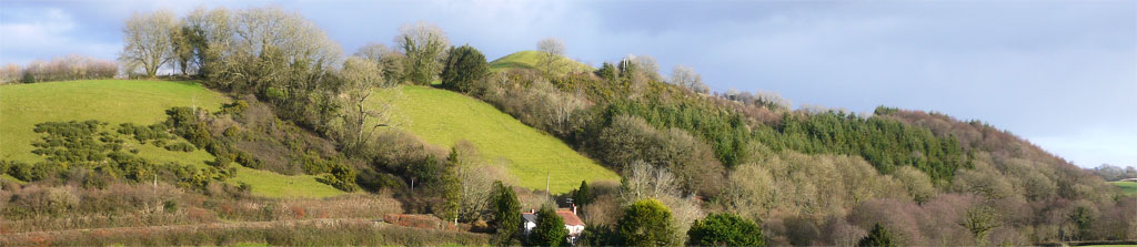
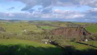
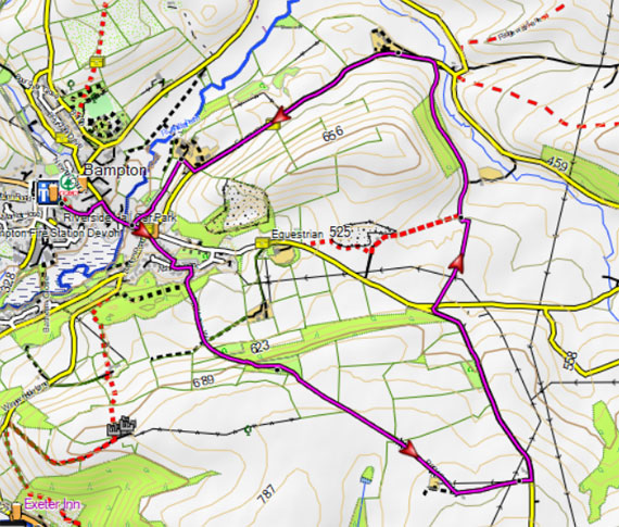
This is a most delightful walk into a totally unspoilt part of Devon.cIt starts in Bampton and steadily climbs to Bampton Down along an old packhorse path to Exeter, with stunning views on either side of the bridle paths It returns via an old track possibly dating back to the Romans .
A Roman fort was found not far from Cudmore Farm.
The Walk
AFrom the main Car Park , head towards gate entrance to Church.
Continue along church path to far end of church yard.
At end of bridle way, turn Left onto Mary Lane.
At T Junction, turn Right and continue along Brook Street.
BAfter crossing river, bear Left on to public footpath.
At end of footpath, turn Left into Ashleigh Park.
After 78m (soon), turn Right onto another footpath.
Continue through wooded area (Packhorse Way).
When reaching fields, continue with hedge on left passing farm yard.
At lane, turn Right.
After 390 m , turn Left onto a track.
At edge of wood, turn Left onto a bridleway.
CAt Bampton Down Cross where Bampton Down Road starts, turn Left on to a track.
After 75 m (soon) , turn Right following a track out of the woods.Enjoy spectacular views!
At end of track, turn Right.
Then almost immediately, turn Left and continue along the lane descending towards Downhill Farm.
At T junction, turn Left.
DWhere lane curves to right, bear Left onto a track.
Where the track meets a junction of lanes, continue onto lane (Fordmill Cross) passing various buildings.
EAfter crossing a stream, turn Left onto a track which eventually skirts a wood.
When you see another track on Right, turn Right onto track.
FThis joins a small lane. After 65 m, turn Right onto a public footpath.
Where it joins a lane, turn Right Old Tiverton Road.
Continue back to Bampton.
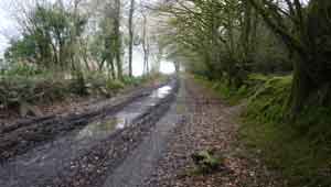
During the winter wellingtons are recommended.
You can download the route and follow it on your mobile phone or GPS device..

length: | 6.9 miles |
time: | 3 hr 5 mins |
terrain: | tracks bridle/ footpaths |
| country lanes | |
Points of Interest | views |
main roads | 0 % |
6% | |
altitude range | 99 - 241 m |
quality of track | *** |
stiles | 5 |
| yes |
There is one steep climb.
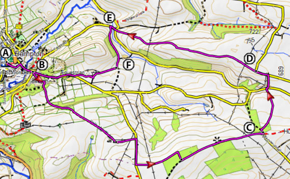
Map of Walk 1
| Walks near Bampton | |
| Tiverton | |
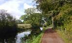 | Various options including a delightful canal walk - you may meet a shire horse pulling a barge! |
| Knightshayes | |
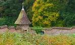 | Great walks around Knightshayes' estate with its beautiful gardens and an impressive victorian Gothic mansion. |
| Oakford | |
 | Oakford, on the edge of Exmoor, makes an ideal centre for exploring hidden undisturbed valleys and magnificent woods. |
Walk 2 Wide views (4.0 miles)
Difficulty:![]()
A shorter but equally pleasant walk following public foot paths. It also starts from the main car park.
Map of Walk 2